
Mountain Weather
Met Office Mountain Specialist Forecast
The Met Office now have a much improved Mountain specific forecast. Detailed forecasts include a break down of elevation to show temperature, wind, gusts and wind chill.
https://www.metoffice.gov.uk/weather/specialist-forecasts/mountain
Mountain Weather Information Service
This is the traditional mountain weather forecasting site. You'll often find this forecast printed in cafe's, hostels, tourist information so it's worth becoming familiar with the format.
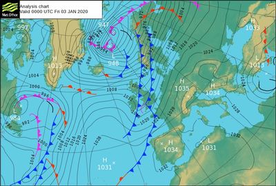
Worldwide Weather - NullSchool
See a digital map of current wind and weather, around the world. This gives you a better understanding of approaching weather systems and how those weather systems interact with each other.
Avalanche Information

Scottish Avalanche Information Service
The SAIS publish daily reports of observed and forecast, avalanche, snow, and mountain conditions for the 5 most popular mountain areas of Scotland. They provide a daily avalanche hazard report which will be displayed in cafe's, hostels, tourist information, etc. It's essential to be familiar with the format and how to understand the content.
Be Avalanche Aware (SAIS) App
The latest tool for winter adventurers is a handy app with a host of features to help you stay safe in the winter mountains. Slope aspect and angle tools, avalanche hazard reports, snow stability observations and more.
Lake District Fell Top Assessors
Each winter, usually from December to March, Fell top assessors walk up Helvellyn. They check conditions, take photos and supply a report to add to the Met Office weather forecast that appears 365 days a year .
FATMAP
FATMAP is an outdoor adventure platform for web and mobile. We use both platforms to help with route planning and decision making. The 'avalanche' map layer provides an excellent visual representation of the avalanche prone ground (30 degrees and above).
Route Planning

Bing Maps
Bing provide an Ordnace Survey mapping layer for all of Great Britain free of charge! The mapping layer is based on the Ordnance Survey Landranger series (scale 1:50,000).
Google Earth Pro
Google Earth Pro is now free. It gives you a high resolution 3D view of the route you're planning. It allows you to get a good picture of what the terrain will look and feel like along your planed route. You can download the full version or just install the app.
Emergency SMS Service

emergencySMS
If you can’t make voice calls, you can contact the 999 emergency services by SMS text from your mobile phone. An essential service for people with hearing loss or difficulty with speech.
The service is supported by all mobile networks. Even if you don’t have a signal with your network provider, it may be covered by a different network and that provider will relay 999 SMS messages.
REGISTER: You must Register to use this service. Text ‘register’ to 999. You will get a reply – then follow the instructions you are sent. Dot it now, don’t wait until you need it.
IN AN EMERGENCY: Text your message to 999. The emergency service will either ask for more information or will tell you that help is on the way.
OS Locate App
OS Locate App
Used alongside your Ordnance Survey map, OS Locate is a fast and highly accurate means of pinpointing your exact location on the map, anywhere in Great Britain.
Ideal if you have lost your bearings, need to provide an accurate grid reference to emergency services or simply would like a little reassurance. Easy to use and it doesn't require mobile coverage.
Available for apple and android